|
|
||||
|
|
||||
|
|
| The River System | |||||||||||||||
|
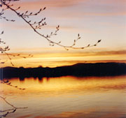
The Merrick Hills, the Rhinns of Kells
and the Glenkens form the catchment area for the Dee River System in
Galloway (see map). Loch Dee and the
Silver Flowe are the source of the Dee River that flows through Clatteringshaws
Loch, the Otter Pool, along the Raiders Road to Loch Stroan and in to
Loch Ken. Joined by the Water of Ken and Water of Deugh, which flow
through Kendoon Loch, Carsfad Loch and Earlston Loch, the Dee flows
on to Tongland and to the sea at Kirkcudbright.
|
 |
||||||||||||||
|
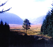
The
head of Polmaddy Burn
|
|||||||||||||||
 |
Seven dams were built along the fifty
miles of river during the 1930's that dramatically changed the course
of the river system. Large areas of land were flooded creating Tongland
Loch, Earlston Loch, Carsfad Loch, Kendoon Loch and Clatteringshaws
Loch. Loch Ken and Loch Doon were considerably extended. The flow of
water was controlled by the dams, which could be opened to allow more
water through to drive the turbines in the generating stations. Water
from Loch Doon, which had previously flowed down the river Doon to Ayr,
could be added to the Dee system through a pipeline constructed at Drumjohn.
|
||||||||||||||
|
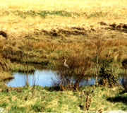
There are numerous small lochs in the
upper stretches of the rivers, set in some of Galloway's most beautiful
surroundings, and providing many walks among the hills. Loch Ken provides
water sports and there is coarse fishing at many of the lochs and on
much of the river.
|
 |
||||||||||||||